


The official Flutter MapLibre GL plugin maintained by the MapLibre organization. This is the established and widely-used Flutter binding for MapLibre Native.
Quick start
flutter pub add maplibre_glimport 'package:flutter/material.dart';
import 'package:maplibre_gl/maplibre_gl.dart';
class MapPage extends StatelessWidget {
const MapPage({super.key});
@override
Widget build(BuildContext context) {
return Scaffold(
body: MapLibreMap(
styleString: 'https://tiles.openfreemap.org/styles/liberty',
initialCameraPosition: const CameraPosition(
target: LatLng(20.0, 0.0), // latitude, longitude
zoom: 2,
),
),
);
}
}›Setup noteschecked with v0.27.1
maplibre_gl 0.27.1 on pub.dev. The pubspec line is maplibre_gl: ^0.27.1. It requires Flutter 3.29+ and Dart 3.7+, JDK 21 for Android builds, Android 5.0 (API 21)+, iOS 13+, and a WebGL2 browser for web. Platforms: Android, iOS and Web (no desktop). LatLng takes latitude first. The map needs bounded constraints (for example a Scaffold body). Location permissions are only needed if you show the user's location. On web, since 0.27.0 the plugin loads MapLibre GL JS 6 itself: add nothing to web/index.html, and remove old maplibre-gl.js/.css tags if your index.html has them. Add sources and layers in onStyleLoadedCallback.
Also for Flutter: Flutter MapLibre. Other platforms are on SDKs.
Used by 3 products
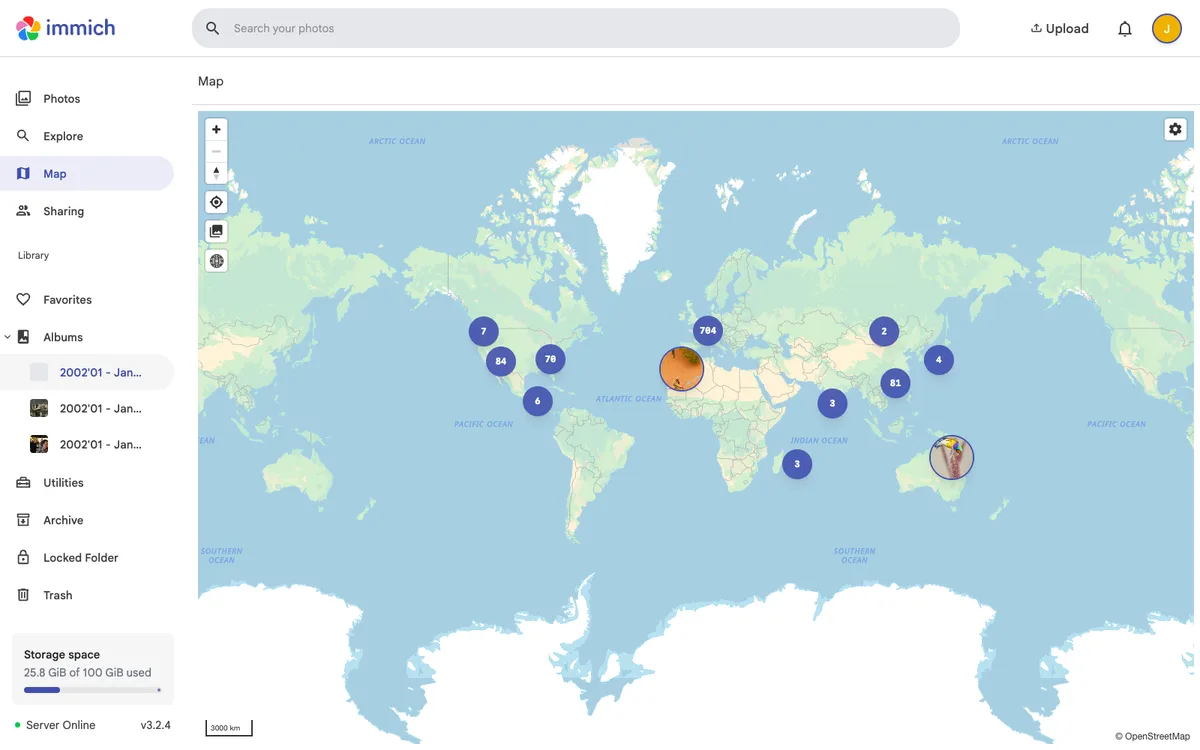

Immich
Self-hosted, open-source photo and video backup and management solution, with web and mobile apps, a map of geotagged photos, and a REST API with TypeScript and Dart SDKs.

SNCF Connect
France's official rail booking and multimodal travel app by SNCF, with interactive transit maps and journey planning.

OCELL
Forest management platform (Dynamic Forest) that uses satellite and drone imagery with AI to monitor and manage forests.